After completing this lesson, you'll be able to:
The VertexCreator takes attributes with coordinates and creates points. This transformer is most useful when:
You can change the Mode parameter to build line, arc, or polygon geometry with the VertexCreator.
Open FME Workbench (2026.1 or later).
Click Blank Workspace to start a new workspace.
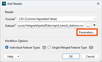
Click Readers > Add Reader and set Format to CSV (Comma Separated Value).
Click the ellipsis button [...] and select the downloaded rapid_transit_stations.csv file, or paste in the URL.
Click the Parameters button:
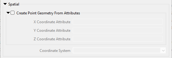
Confirm that Create Point Geometry from Attributes is not enabled. We will instead create the points using a transformer after reading. Your dialog should look like this:
Click OK.
The reader feature type appears on the canvas.
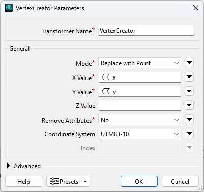
After you add the reader feature type to the Canvas, add a VertexCreator transformer. The VertexCreator creates a point feature of each record using X/Y/Z or Longitude/Latitude/Elevation values stored in the attributes. Each point feature retains all the attributes of the original feature.
Set X Value to the x attribute, Y Value to the y attribute, and the Coordinate System to UTM83-10:
Run the workspace and inspect the results.
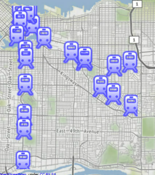
The output of point features using any of the three methods. Stylized in FME Data Inspector using map tiles by Stamen Design, under CC-BY-3.0. Data by OpenStreetMap, under CC-BY-SA.
If your points don't appear correctly on the background map, ensure you set the Coordinate System in the VertexCreator. The points will not be properly georeferenced without setting that.
